Thursday, July 21, 2011

Deer Lake, Newfoundland

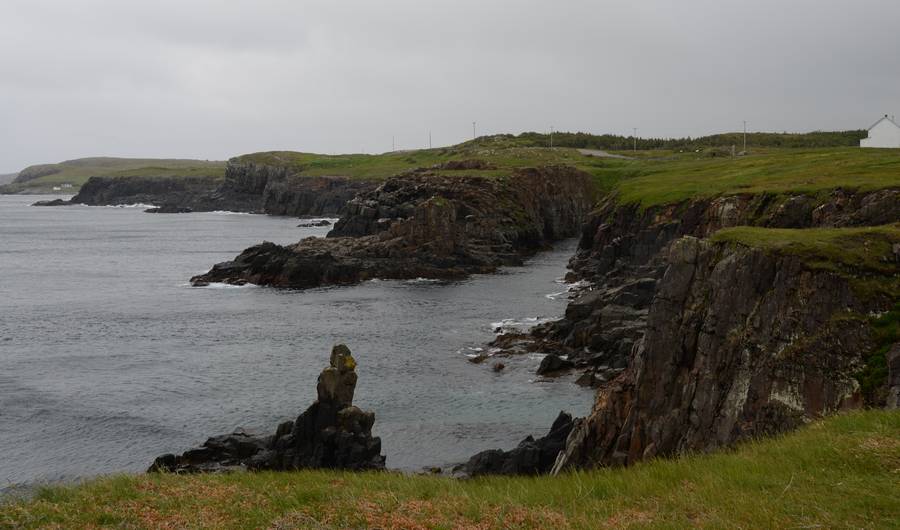
 Looking over to Norris Point, near Gros Morne National Park.
The view from Neddies Harbour Inn, Norris Point.
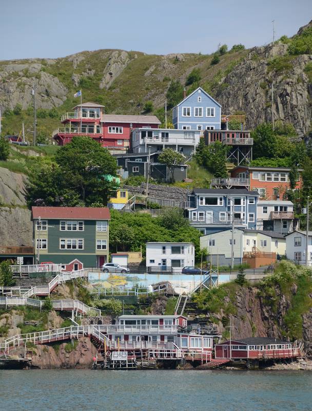
Typical wooden buildings along the shoreline.
As one drives along the road in Newfoundland, you see lots of these vegetable gardens. They are sometimes many kilometres from a settlement. The fence is to keep the moose out and they are sited where the ground is neither boggy nor stony.
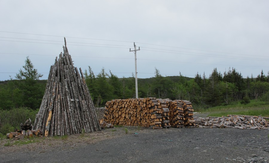
 The other common sight along the road is wood heaps.
 
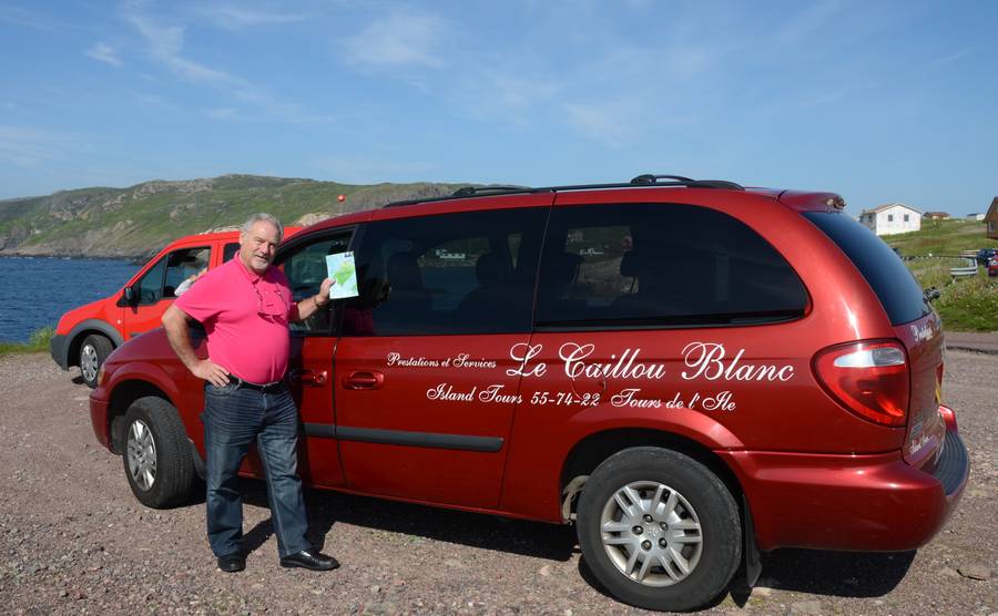
Thursday morning dawned bright and sunny and so it was a pleasant drive up to L'Anse aux Meadows near the Northern tip of Newfoundland,  stopping only to buy a bottle of wine and a small bottle of Screech, the Newfoundland traditional drink, which is actually rebottled and renamed Jamaican rum.

L'Anse aux Meadows is where a Viking expedition from the Norse settlement in Greenland landed in about 1000 A.D. They came and went for only a few years, before burning and abandoning the camp. They mostly came for the timber to repair their ships. It was an added bonus to find wild grapes and they called the area Vinland.
Map showing the probable route taken by the Vikings from Greenland to Newfoundland in 1000 A.D.
Modern Vikings enjoying lunch of fish and bread porridge.
A Viking loom. I am not an expert in weaving, but I was intrigued to see the weaver worked from the top down rather than from the bottom to the top.

Today Parks Canada have built replicas of some of the buildings and have modern Vikings enthusiastically recreating the past. We easily filled in 2 hours until we had to be at the dock to catch the boat to Quirpon Island where we were staying in the lighthouse keeper's cottage. It is only a short boat ride and on the way we had a close inspection of an iceberg. We were fortunate the sea was calm and we were able to land close to the lighthouse. Sometimes people have to walk the 5 km from the opposite end of the island.

Approaching Quirpon Island.
Cape Bauld Lighthouse, Quirpon Island.

We thought it appropriate to sit on the verandah sipping our Screech (Cooled with 10,000 year old iceberg ice), watching the resident icebergs and trying to spot whales.
View from the verandah of the Lighthouse keeper's house at Cape Bauld, Quirpon Island.
What we were drinking as we sat on the verandah.

After a very hot night due to the overheated building, we were surprised when we looked out the window in the morning to see an iceberg had drifted into view!

As we were there only one night we did not have time to explore the island. The weather held and we were able to leave from the landing near the house. Bryce, the boatman not only took us close by a large (by Newfoundland standards) iceberg. The visible portion was about the size of an aircraft carrier. We also saw a seal relaxing on an iceflow and a humpbacked whale performed for us.
Wildflowers on Quirpon Island.
More wildflowers.
Loading our backpacks onto the boat for our return to the mainland.
A humpback whale shows off his tail.
Getting close and personal with an iceberg.

Main Brook our next overnight stay was not far away, so we went to Conche. Like many places in Newfoundland there was no road in until 1969 and even now it is unsealed. Now fishing is more problematic, the community was looking for alternative sources of income. This area is on the French  Shore, so called because from 1713 until 1904, only the French could fish these waters. They were not allowed to settle and returned home to France every winter.  So a French artist designed an equivalent of the Bayeux tapestry and 13 local ladies embroidered it. It tells the story of the area with much humour and great little details. e.g. Confederation with Canada in 1949 is represented by a Canadian beaver and a Newfoundland dog shaking paws.
Although no photos are permitted of the actual French Shore Tapestry this extra panel was embroidered by local school children.
A partly embroidered panel. The tapestry is on 16 inches wide natural linen and is 222 feet long. The colours of wool used are the same as in the Bayeux tapestry. Twelve local women sat around a wooden frame and embroidered working from sketches sent from the artist in France. It is a most impressive work of art, but Conche is out of the way, so it will be difficult to put it on the tourist trail.

Saturday was showery, but improved over the morning and as we had to return south by the same road we had driven north on, we decided to try our luck again at Western Brook pond and walked in again. The photos below taken during the two hour boat ride will show why I thought the 12 kms of walk worth it!
Western Brook Pond. Fortunately the mist was almost clear of the top of the gorge.
One of many falls at Western Brook Pond.
The tin man face.

Now suddenly it was our last day. We had stayed in Corner Brook and thought we  should find the Captain Cook monument before we left. Our GPS has given up the ghost and the streets were often one way and unnamed, but we eventually found it.

Glynmill Inn, Corner Brook - built in 1924 as an executive guest house during the construction of the pulp and paper mill.
Inscription on the Cook Memorial. It records that his good work in Newfoundland helped him to win the commission to explore in the Pacjfic.

The last excursion was to Big Falls to see the salmon leaping. It was not in the tourist literature, but a Canadian at breakfast had recommended it. There was 16 km of pot holed gravel to get there, but we did see some fish trying to leap the Falls which made it worthwhile. Apparently last week was much better before all the recent rain raised the river level.
Big Falls. We did see a few brave salmon try to leap up, but we did not see any succeed.

This is my last post as we are now back in Australia after an interesting and enjoyable  holiday.

Thursday, July 14, 2011

Gros Morne National Park, Newfoundland

The photographs below missed my last post, but I put them in here, even though we are now well back in Newfoundland.
Waiting for the International ferry from Canada to arrive in St Pierre
Seems like there are still old whisky crates from prohibition days in St Pierre. This one was being used to record visitors votes in a photographic competition at the museum.
Old photograph showing the stacks of whisky crates on the pier in St Pierre during prohibition.

Well, the Newfoundland weather has caught up with us. Last Sunday when we were on the Bonavista Peninsula it blew a gale and rained intermittently. After exploring the Heritage area of Trinity, we tried to walk out on the cliff at Elliston to see the puffins, but the wind was so strong it was too scary. However Monday morning was bright and clear and calm, so we went back to the puffin site and were glad we had returned.

From Trinity we explored around the Twillingate area on our way to our next stopover at Bluewater Lodge. It was log cabin style very comfortable and nice people, but in the middle of nowhere - in the forest by a lake, with no real views.

Tuesday morning it was raining and it hardly stopped all day. At times it was just sheeting down and the water was hardly running off the highway. We thought it a good day for museums and coffee shops.

There was a very good small museum in Grand Falls-Windsor and as part of the $2 entrance fee there was free entry to the Loggers museum in the forest just outside town.

This morning when we woke it was foggy and still inclined to rain. We were booked on a boat trip into West Brook pond which apparently is a spectacular fiord. It is a 3 km walk into the boat dock.

Anyway we thought we might as well walk down the track to the water. it was a pleasant walk and there were some wildflowers, but the boat trip was cancelled as the fog did not lift at all and the maximum temperature was 9. Apparently the weather means the trip is cancelled about twice a week on average and this is summer!

Everybody keeps warning us about moose on the road. Someone introduced 2 pairs in 1878 and now there are more than 120,000 on the island and they cause a lot of fatal accidents. They are big!

Anyway cross your fingers for tomorrow.
 L plate driver - Newfoundland style
19th C house in Trinity. The internal walls are vertical boards (spruce?) covered in wallpaper. There are no studs so they are less than 2 inches thick.. I think it is called balloon construction
 Crazy patchwork quilt.
Typical indented rocky Newfoundland coast. James Cook spent 4 years in the 1760s charting these bays.
 Last Sunday we saw how angry and dangerous the sea can  be.
The view from our room at the Fishers' Loft Inn, near Trinity.
 The view from the dining room at the Fishers' Loft Inn
 A puffin spreading its wings. They look very ungainly in the air as they beat their wings rapidly.
 Another puffin poses. They are comical appealing birds, but much smaller than I expected.
 Long Point Lighthouse, near Twillingate. There are no shortage of lighthouses, some still manned.
 The Loggers Museum. You will have to imagine the mosquitoes.
 Interior of one of the huts. As you can see, a pretty Spartan place to live for months at a time.
 The view from Neddies Harbour Inn, Norris Point - just outside Gros Morne Park
Canadian Burnet(t?)
 Bakeapple -like a Newfoundland wild raspberry. This one is unripe. When ripe they are orange.
 Arethusa or Dragon's Mouth
 Late afternoon on Wednesday and the fog has not lifted.


Sunday, July 10, 2011

St Pierre et Miquelon, France

I could not resist putting St Pierre as the location of this post. It is three small islands off the south coast of Newfoundland.

After we left Ottawa we spent a couple of days wandering around south west Quebec. The villages mostly have a large church with an ornate bell tower. The village of Hudson is obviously home to really wealthy people - from Montreal? - the homes were huge on huge blocks and with frontages to the St Lawrence river. We did make the mistake of getting too close to Montreal and into the nightmare rat's nest of motorways!
One of the more modest bell towers

On Tuesday we flew to St John's, Newfoundland via Halifax. Front page of the Halifax paper was the renaming of a High School. It has been named Cornwallis after an early British Governor, but the local MicMac Indians objected because he had put a price on MicMac scalps. However someone had written to the paper saying it was not quite that simple. Apparently the local leader of the French (who incidentally was a Jesuit) had previously put a price on the English to encourage the Micmacs to help the French. They played hard in the 18th C.

In St John's we picked up a Ford Fusion with no maps and were dismayed when our GPS did not know St John's existed. We tried all possible spellings and it is a city of about 100,000 people but no luck.. Fortunately it did recognise the post code, but no marks to GPS.

Wednesday we puffin and whale watched. There was quite a swell - made keeping the camera lined up very difficult. Further adventures included  a flat tyre. We changed the wheel and went back to Enterprise and changed the car for a Nissan Altima.

Puffins viewed from a heaving boat.
The swell made it hard to keep the humpbacks in the frame.
Ferryland Lighthouse where we had a "Gourmet Picnic"
The idyllic site made it worth the 20 minute uphill walk from the Car Park

Thursday morning we toured the town. Since the collapse of the cod stocks, fishing is no longer so important and I gather the Port is only a shadow of its old self. The town itself has steep narrow streets and rows of wooden terrace houses painted in bright colours. Trivia fact - St John's is much closer to London than Vancouver.
Immaculate 1925 "Roller" at Cape Spear. It has AWB (All wheelbrakes)
Bright sunshine and then the fog rolls in and the eerie sounding foghorn starts to sound.
Blue Fleur de Lis. The emblem of Quebec but it grows wild all through Eastern Canada.
Looking down on St John's Harbour from Signal Hill. This was where Marconi received the first Morse signal from Cornwall in 1901.
Typical view of St John's houses straggling up the steep hills.
There are still a few fishing boats working out of St. John's
In the afternoon we drove to Marystown. The roads are mostly good, but sometimes slow and winding.

Friday morning we drove to the Burin Peninsula on the way to Fortune to catch the St Pierre ferry. The coastline of Newfoundland is incredibly indented and the Burin is no exception. It was Captain Cook who charted the coast in the 1760s.

On the Burin Peninsula.
Another view around the Burin Peninsula.

The ferry to St Pierre is not much bigger than a sharkboat. We had about 40 passengers and out on the deck there was quite a bit of spray. As we crossed into French waters the Canadian flag was lowered and the tricolour hoisted.
As the ferry crosses into French waters the Tricolour is hoisted.

The islands of St Pierre, Miquelon and Langlade have a population less than 7000 and the area of St Pierre is 25 sq km. France sends 32 police to keep order. It is a popular posting. There are 10 doctors on St Pierre and every month a specialist comes from France. A weekly cargo boat from Halifax supplies the island.

There is a new smart airport which can land Boeing 737s and most French presidents come to visit. France obviously subsidises their only outpost in North America, a tiny remnant of when they claimed from the St Lawrence to New Orleans.

It is a fascinating and the restaurants serve authentic French food. In the museum there is a guillotine, used once in 1889. The heyday was during prohibition when 300,000 cases of spirits a month passed through St. Pierre. Al Capone was a visitor.

Typical street in St Pierre. Footpaths are pretty optional, note the porches.
Most houses are painted in bright colours
This house was built from whisky crates. During prohibition the liquor was transferred from the crates to jute packing for the smuggling run. As a result St Pierre had to find a use for the timber from 300,000 cases a month! They used it for fuel and building.
Capstan for hauling up fishing dories on St Pierre.
Jean-Claude, our guide on St Pierre.
Merry go round on the foreshore in St Pierre.